

UrbanFootprint enables you check flood risk by postcode, providing detailed exposure assessments through data-driven climate models. As flooding risks escalate with climate change, this platform offers critical insights for cities, businesses, and communities evaluating vulnerability at the location level. The system translates complex environmental data into actionable risk intelligence that shapes investment decisions and urban planning strategies.
Climate change drives rising sea levels, extreme rainfall events, and increased urban density in vulnerable areas. UrbanFootprint combines satellite imagery, hydrological models, climate projections, and land-use data to assess flood risk by location. This article examines how data platforms are transforming the way communities plan for environmental risk, moving beyond historical patterns to model future scenarios.
Flood risk assessment evaluates the probability and potential impact of flooding at specific locations. Traditional assessments relied on historical flood records and basic topographical data. Modern approaches incorporate multiple data layers including elevation models, precipitation patterns, drainage capacity, soil permeability, and projected climate scenarios.
The analysis identifies areas vulnerable to different flooding types. Coastal flooding results from storm surge and sea level rise. Riverine flooding occurs when waterways exceed capacity. Pluvial flooding happens when rainfall overwhelms drainage systems. Each type requires different modeling approaches and mitigation strategies.
Risk assessment produces probability estimates across time horizons. A location might face a one percent annual flood probability today, but climate models may project that risk increasing to five percent by 2050. These projections inform long-term planning decisions for infrastructure, development, and insurance.
UrbanFootprint processes multiple data sources to model flood exposure. The platform integrates digital elevation models that map terrain at high resolution, identifying low-lying areas and natural drainage patterns. Satellite imagery tracks land cover changes, impervious surfaces, and development that affects water absorption and runoff.
Climate models provide precipitation projections and sea level rise scenarios. The platform runs simulations across different climate pathways, calculating flood depths and extents under various conditions. Hydrological modeling accounts for water flow, accumulation, and drainage capacity across the landscape.
The system aggregates risk data to postal code boundaries, enabling location-specific queries. Users can examine current flood zones, projected future risk, and the factors driving vulnerability at any address. The platform quantifies both the likelihood of flooding and the expected depth of water during flood events.
UrbanFootprint updates its models as new data becomes available. Recent satellite passes, updated climate projections, and observed weather patterns feed into refined risk calculations. This approach captures emerging risks that static flood maps might miss.
Flood risk varies significantly across short distances. A development on one side of a street might sit above the flood plain while properties across the road face regular inundation. Postcode-level granularity captures these local variations that regional assessments overlook. Property transactions require precise risk information.
Broad regional data proves insufficient for these financial decisions. Urban planning operates at neighborhood and parcel scales. Zoning decisions, infrastructure investments, and development approvals depend on detailed risk mapping. Cities need to identify which specific blocks require drainage improvements or should be restricted from development.
Emergency planning demands address-level precision. Evacuation routes must account for which streets will flood first. Resource allocation requires knowing which neighborhoods face the highest risk. Response protocols depend on accurate predictions of flood timing and severity by location.
Municipal governments integrate flood risk analytics into comprehensive planning. Land-use regulations limit development in high-risk zones or necessitate elevated construction and flood-resistant design. Capital improvement initiatives focus on drainage improvements and flood control infrastructure based on vulnerability evaluations.
Risk data directs climate adaptation strategies. Cities confronting increasing flood exposure create managed retreat initiatives, resettling residents from vulnerable areas. Others invest in green infrastructure like wetland restoration and permeable pavement to soakup stormwater. The analysis detects which interventions provide the greatest risk reduction.
Building codes adapt informed by anticipated risk. Communities revise elevation requirements for new construction, mandate flood-resistant materials, and establish buffer zones from waterways. These regulations show forward-looking hazard stimulations instead of historical flood boundaries.
Public communication depends on available risk information. Charting and measuring flood risk at the postcode level allows residents to understand their exposure. Cities release interactive charts displaying existing and anticipated flood zones, helping communities make informed decisions about property and safety.
Insurers utilize climate risk analytics for pricing flood coverage and mitigate portfolio exposure. Conventional actuarial models relying on historical claims data unable to account for emerging risks from climate change. Forward-looking models incorporating ocean level increase and rainfall pattern changes offer more accurate hazard evaluation.
Insurance decisions depend on location-specific exposure. Insurers evaluate whether to provide insurance, set premium rates, and determine coverage limits based on projected inunfation levels and frequencies. Properties in areas encountering increasing risk may see coverage restrictions or higher costs.
Portfolio management requires aggregate risk assessment throughout all policies. Insurers evaluate total exposure in flood-prone regions to prevent concentration risk. The analysis identifies geographic areas where the company should limit coverage or increase reserves.
Reinsurance markets depend on detailed risk stimulation. Companies that insure insurers need precise estimates of potential losses from major flood events. Climate risk analytics inform reinsurance pricing and coverage terms, impacting the entire insurance value chain.
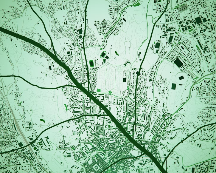
Image: Unsplash
Real estate developers evaluate flood risk before acquiring land or planning projects. Properties in high-risk areas encounter higher construction expenses for elevation and flood protection. Development timelines increases when projects need environmental permits and flood evaluation measures.
Property values show flood vulnerability. Buyers reduce prices for homes in flood zones or facing increasing future risk. Commercial real estate investors evaluate tenant risk and possible business interruption from flooding. The evaluation influences acquisition decisions and pricing negotiations.
Long-term asset management requires climate risk assessment. Property owners assess whether to invest in flood protection, relocate operations, or withdraw vulnerable assets. Portfolio diversification strategies give account for geographic concentration of flood risk.
Creditors incorporate flood risk into credit approvals. Loan assessment evaluates whether properties encounter flooding that could damage collateral value. Commercial real estate loans include aggrements mandating flood insurance and may limit loaning in high-risk zones.
Traditional flood charting presumed stable climate conditions. Historical rainfall patterns and river levels provided the fundamental for risk evaluation. This practice fails when climate change changes precipitation, sea levels, and storm intensity.
Climate-driven stimulants incorporate diverse warming scenarios. The analysis evaluates risk under different greenhouse gas emission pathways, indicating how flood exposure changes if temperatures rise two degrees versus four degrees. These scenarios demarcate the range of preferable futures.
Ocean level increase projections differ by location ss a result of ocean dynamics, land subsidence, and ice sheet behavior. Coastal areas encounter different risk trajectories. Stimulants give account for these regional variations instead of applying uniform global estimates.
Precipitation changes impact both rainfall intensity and seasonal distribution. Some regions encounter more frequent extreme rainfall activities while others experience longer droughts interrupted by intense storms. Flood models incorporate these changing patterns rather than estimating from historical averages.
The combination of factors produces unpredictable risk variations. A location might observe minimal flood risk increase until reaching a boundary where ocean level increase and storm spike merge to trigger frequent inundation. Comprehending these boundaries is important for long-term planning.
Transportation networks need flood resilience. Roads, bridges, and railways in vulnerable areas require elevation or flood protection. Transportation planners use hazard evaluations to prioritize enhancements and detect alternative routes that sustain networks in flooding situations.
Telecommunications networks rely on equipment that breaks down when flooded. Cell towers, switching stations, and data centers demand flood protection or strategic siting. Network operators make use of risk charting to guarantee communication resilience during disasters.
Flood risk models contain uncertainties that impacts evaluation accuracy. Climate projections differ throughout different modeling strategies. Precipitation forecasts carry greater unpredictability than temperature projections. Local drainage capacity relies on infrastructure condition that may not be completely mapped.
Elevation data resolution impacts model accuracy. High-resolution LIDAR surveys capture terrain details that rougher satellite data lack. Zones deficient of detailed elevation mapping display higher unpredictability in flood intensity predictions.
Human actions present uncertainty. New development modifies drainage patterns. Drainage improvements limit flood hazard. Wetland loss improves vulnerability. Stimulants need to be updated frequently to reflect these landscape modifications.
Infrequent event modeling appears challenging. The most extreme floods happen scarcely, providing decreased historical data for model validation. Extreme situations require estimation that entails more unpredictability than assessments of frequent flood activities.
Flood risk overlaps with other climate hazards. Coastal areas encounter combined threats from sea level rise, storm spike, and inland flooding. Heat stress and flooding generate compound risks for vulnerable populations. Thorough risk assessment examines these interactions instead of treating dangers in disconnection.
Social vulnerability influences community resilience. Low-income neighborhoods may encounter higher flood susceptibility because of historical development tendencies. Limited resources restrict adaptation capacity. Equity analysis analyzes whether flood risk and coping strategies are distributed fairly.
Economic factors structure risk management decisions. Property values, insurance availability, and public budgets influence which adaptation measures prove practical. Communities harmonize flood protection expenses against other needs and priorities.
Ecological considerations impact flood management approaches. Natural flood control through wetlands and floodplains provides resilience while supporting biodiversity. Nature-based solutions provide alternatives to traditional gray infrastructure like levees and flood walls.
Cities encounter decisions about growth strategies in a period of rising flood hazard. Continuing development in vulnerable areas increases exposure and future adaptation costs. Directing growth to safer locations demands challenging existing land use patterns and property rights.
Adaptation costs will increase as flood risk increases. Communities must decide whether to protect, accommodate, or withdraw from vulnerable areas. Each strategy carries different costs and benefits that differ by location and community values.
Regional coordination becomes essential as watersheds cross jurisdictions. Upstream development impacts downstream flood hazard. Efficient flood management requires cooperation between local governments, counties, and states that share river basins and coastal areas.
Innovation in flood resilience continues progressing. New construction techniques, materials, and infrastructure blueprints limit vulnerability. Data platforms allow more advanced risk assessment and specific interventions. The challenge resides in executing these solutions at the scope and speed that climate change requires.
Wrapping up, flood hazard assessment has become fundamental infrastructure for adaptable cities and knowledgeable investment. Tools like UrbanFootprint translate complicated climate information into actionable intelligence that directs planning, development, and resource allocation decisions. The capacity to verify flood risk by postcode enables precise evaluation of vulnerability at the location level. This specificity supports better decision-making throughout sectors from real estate and insurance to local government planning and infrastructure development.
Location-based climate hazard analysis will increasingly influence urban development patterns. As flood exposure increases with climate change, communities that incorporate risk information into planning decisions will prove more adaptable than those depending on obsolete assumptions. The platform strategy for climate risk analytics represents not only improved mapping and measuring flood risk, but an essential transition in how cities prepare for environmental change.